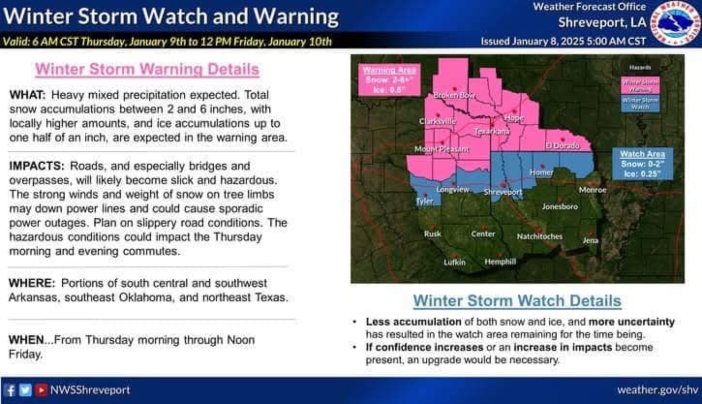

The National Weather Service in Shreveport has upgraded the Winter Storm Watch for the Texarkana region to a Winter Storm Warning, signaling significant impacts from the approaching storm system.
Forecast Details:
- Precipitation: Heavy mixed precipitation, including 2 to 6 inches of snow, with some localized areas potentially seeing higher amounts. Ice accumulations of up to half an inch are also expected.
- Hazards: Roads, bridges, and overpasses will become slick and hazardous. The combination of strong winds and the weight of ice and snow on trees could lead to downed power lines and sporadic power outages.
- Timing: Hazardous conditions are expected to affect travel Thursday morning and evening. Refreezing could create additional dangers during the Friday morning commute.
Impact:
Drivers are urged to exercise caution, especially on untreated surfaces and elevated structures. Residents should prepare for potential power outages and limited travel.

While the Texarkana area will bear the brunt of the storm, other parts of the Ark-La-Tex region under a Winter Storm Watch may still experience dangerous conditions, with a possibility of upgrades to warnings.
Stay tuned for updates as this situation develops, and monitor local advisories for the latest information.